
Oslo city centre in mid-december: temperatures above freezing and no snow in sight. Photo by iselin rønningsbakk / cicero.
Seasonal forecasts for this winter were markedly accurate, with mild conditions in Northern Europe in December and January predicted already in October. Researchers in the S2S4E project are now working to find out how to improve the reliability of future outlooks.
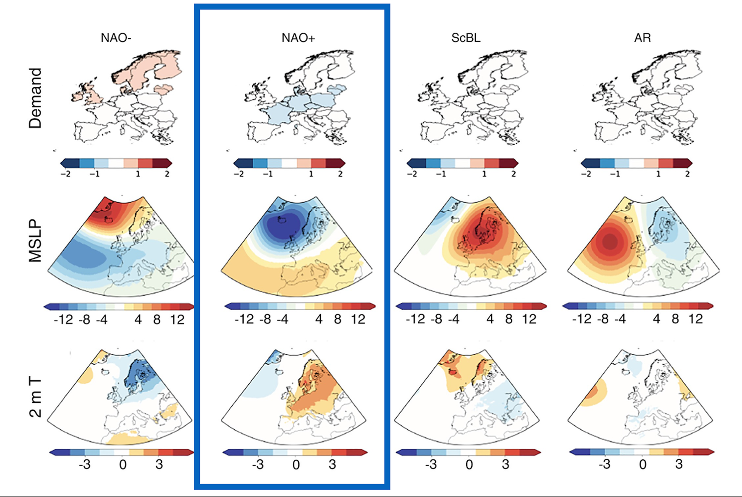
As we wrote in October – before the onset of the current unusually mild winter in Northern Europe – the seasonal forecast models for this winter from the world’s six leading weather agencies all showed a clear signal for a positive North Atlantic Oscillation (NAO) phase.
“This normally translates into warmer and wetter weather than average in Northern Europe, and colder and drier conditions than normal in Southern Europe,” explains Nathalie Schaller, senior researcher at CICERO Center for International Climate Research, and involved in the S2S4E project.
The seasonal forecasts published in November for the December-February period, and in December for January-March were on the same path, and showed a clear positive NAO signal, with warmer than average temperatures in the northern part of Europe.
Unusually mild December and January
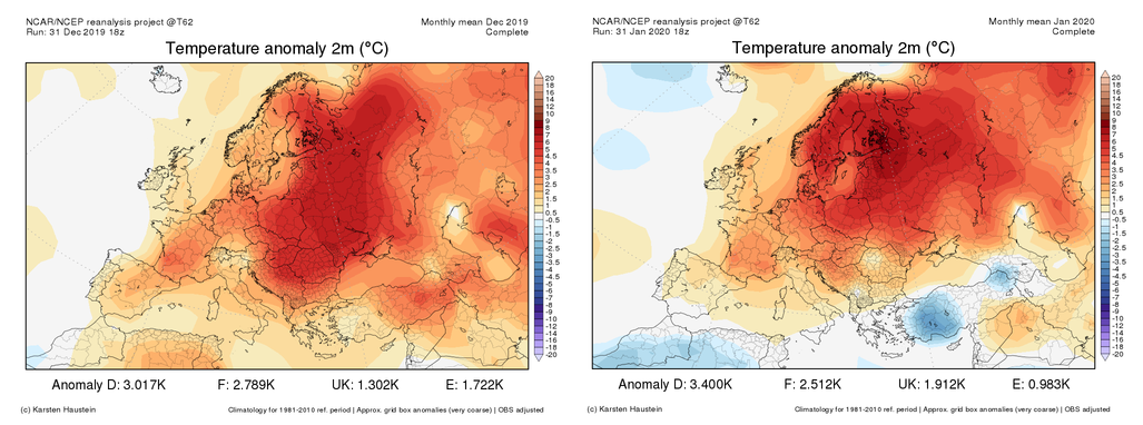
Now that December and January are over, we see that the seasonal forecasts were right: this winter has so far been markedly warmer than normal in Europe, and temperature records have been broken in several countries, particularly in the northern part of the continent.
“The record high temperatures in December and January are likely due to a combination of the strong positive NAO phase, and the fact that the earth has already warmed by more than 1⁰C since pre-industrial times,” Schaller explains.
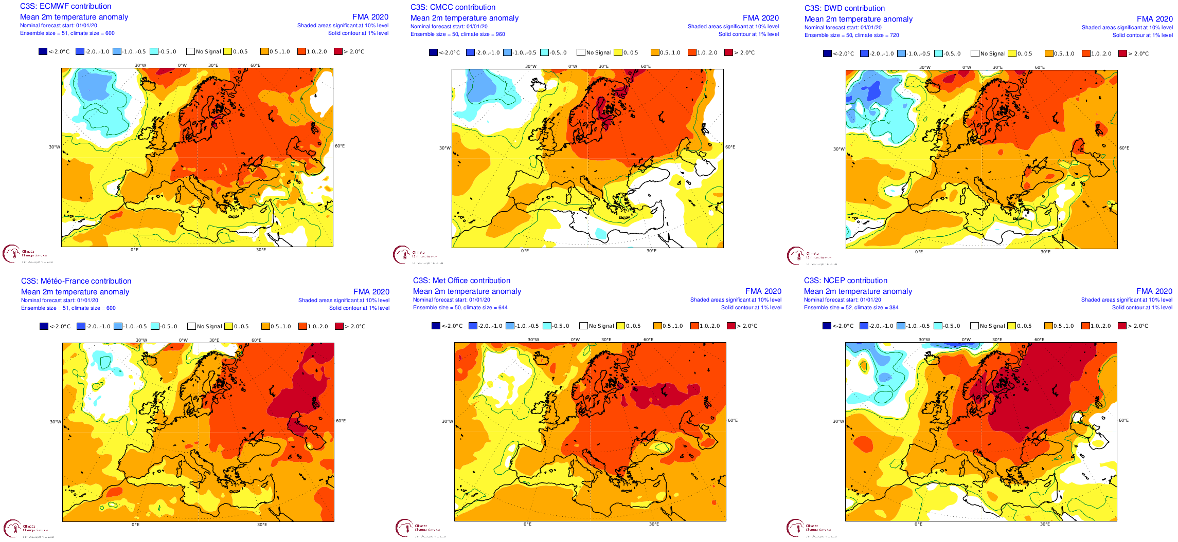
Over the coming months, researchers involved in the S2S4E project will analyse why the weather models turned out to be so accurate in their predictions for this winter, because understanding the reasons why could help scientists improve the models.
Lower than normal electricity demand
The unusually warm temperatures seen in December and January may have resulted in substantial reductions in electricity demand in Europe, due to a reduced need for heating.
So, in terms of energy trading, one thing is certain, and that is that this winter, the winners are those who have based their decisions on the seasonal forecasts.
“Modelling work within the S2S4E project has shown that each European country has a very different sensitivity to winter temperatures depending on multiple factors, such as the amount of electric heating installed, or the resilience of the population to cold weather,” explains Hannah Bloomfield, a researcher at the University of Reading, who is also involved in S2S4E project.
“The electricity demand in France is particularly sensitive to temperature, due to their reliance on electric heating. Here, temperatures in December and January averaged 3°C above the seasonal norm, and our models show power demand averaging 6 GW below normal,” Bloomfield says.
“In Sweden, meanwhile, it was about 5°C warmer than normal, and this implies that demand would have been around 2 GW lower than average,” says Bloomfield, adding that “similar results are seen in Norway and Finland.”
More wintry conditions ahead?
But the winter is not over yet so the question remains: Could we still get some more winter weather before spring sets it?
If you look at the seasonal forecast model simulations launched at the beginning of January, the answer is no, as these indicate that the weather will remain warmer than normal until the end of April, explains Schaller.
“The latest medium-range weather forecast simulations show a similar picture, predicting an almost record positive NAO over the coming weeks, meaning Europe will see more of the same mild weather,” Schaller adds.
About S2S4E
S2S4E (Sub-Seasonal to Seasonal Climate Forecasting for Energy) is a project funded by the EU's research and innovation programme Horizon 2020, which is working to make long-term forecasts more reliable and useful.
To achieve this goal, S2S4E has developed a new forecasting tool particularly tailored for the energy industry – the S2S4E Decision Support Tool – which is free to use at least until the end of November 2020.
S2S4E is coordinated by Barcelona Supercomputing Center and the 12 partners in the project come from seven different countries in Europe (Spain, France, Norway, Germany, Italy, United Kingdom and Sweden).
For more information about the S2S4E project, please visit the project website.
Written by Iselin Rønningsbakk / CICERO. First published on the CICERO website on 3 February 2020.